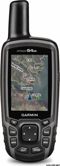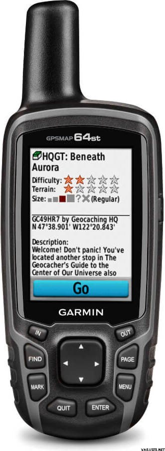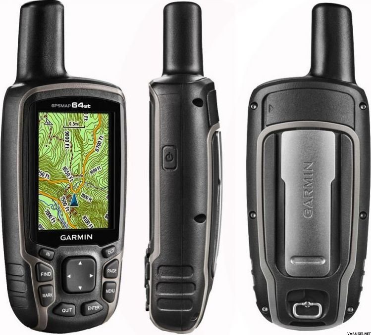
Garmin GPSMAP 64st
Denna produkt är inte tillgänglig för närvarande.
Lagersituationen
Omdömen
| Allmänt betyg | (20 omdömen) |
Produktbeskrivning
Rugged, Full-featured Handheld with GPS, GLONASS and Wireless Connectivity
2.6" sunlight-readable color screen
High-sensitivity GPS and GLONASS receiver with quad helix antenna
1-year BirdsEye Satellite Imagery subscription
3-axis compass with barometric altimeter
Wireless connectivity via Bluetooth® technology¹ or ANT+™
GPSMAP 64s
GPSMAP 64s features a 2.6” sunlight-readable color screen and a high-sensitivity GPS and GLONASS receiver with a quad helix antenna for superior reception. GPSMAP 64s includes a 3-axis electronic compass with barometric altimeter, wireless connectivity and a 1-year BirdsEye Satellite Imagery subscription.
Get Your Bearings
GPSMAP 64s has a built-in 3-axis tilt-compensated electronic compass, which shows your heading even when you’re standing still, without holding it level. Its barometric altimeter tracks changes in pressure to pinpoint your precise altitude, and you can even use it to plot barometric pressure over time, which can help you keep an eye on changing weather conditions.
Share Wirelessly
Share your waypoints, tracks, routes and geocaches wirelessly with other compatible devices. Your friends can enjoy your favorite hike or cache without waiting for you to plug in to your computer — simply press “send” to transfer your information to another Garmin handheld.
GPSMAP 64st also connects to compatible Garmin devices, including VIRB™ and accessory sensors, including tempe™, foot pod and heart rate monitor.
Stay Connected
With Smart Notification you can wirelessly receive email, texts and alerts from your compatible iPhone® 4s or later. Stay connected without having to dig into your backpack for your smartphone.
Explore the Terrain
GPSMAP 64s comes with a built-in worldwide basemap with shaded relief plus a 1-year BirdsEye Satellite Imagery subscription, so you can navigate anywhere with ease. With photo navigation, you can download geotagged pictures from the Internet and navigate to them.
Keep Your Fix
With its quad helix antenna and high-sensitivity, GPS and GLONASS, receiver, GPSMAP 64s locates your position quickly and precisely and maintains its location even in heavy cover and deep canyons. The advantage is clear — whether you’re in deep woods or just near tall buildings and trees, you can count on GPSMAP 64s to help you find your way when you need it the most.
Add Maps
GPSMAP 64s comes with a built-in worldwide basemap with shaded relief and a 1-year subscription of BirdsEye Satellite Imagery for a photo-realistic view. Adding more maps is easy with our array of detailed topographic, marine and road maps. With 4 GB of onboard memory and microSD™ card slot, you can conveniently download TOPO 24K and 100K maps and hit the trail, plug in BlueChart® g2 preloaded cards for a great day on the water or City Navigator NT® map data for turn-by-turn routing on roads (see maps tab for compatibility). In addition, the 64s is compatible with Garmin Custom Maps, a map format that allows you to transform paper and electronic maps easily into downloadable maps for your device, for free.
Find Fun
GPSMAP 64s supports paperless geocaching with 250,000 preloaded caches with hints and descriptions from Geocaching.com, and has a 16-hour battery life. By going paperless, you're not only helping the environment, but also improving efficiency. GPSMAP 64s stores and displays key information, including location, terrain, difficulty, hints and descriptions, which means there’s no more manually entering coordinates and paper printouts! Slim and lightweight, 64s is the perfect companion for all your outdoor pursuits.
Plan Your Next Trip
Take charge of your next adventure with BaseCamp™, software that lets you view and organize maps, waypoints, routes and tracks. This free trip-planning software even allows you to create Garmin Adventures that you can share with friends, family or fellow explorers. BaseCamp displays topographic map data in 2-D or 3-D on your computer screen, including contour lines and elevation profiles. It also can transfer an unlimited amount of satellite images to your device when paired with a BirdsEye Satellite Imagery subscription.
Denna produkt kan levereras endast med de följande metoderna:
- Avhämtning i butiken
- Avhämtning från paketautomat (Posti)
- Avhämtning från paketautomat (PostNord)
- Avhämtning på paketserviceställe (Matkahuolto)
- Avhämtning på paketserviceställe Posti
- Avhämtning på paketserviceställe (PostNord)
- Avhämtning på R-kiosks eller K-Markets avhämtningsställe (DB Schenker)
- Brev med uppföljning
- EUR-pall, på överenskommen tid
- EUR-pall, under arbetstid
- Experssleverans till mottagarens adress (DHL Express Worldwide)
- Leverans till mottagarens adress (DB Schenker)
- Leverans till mottagarens adress (Matkahuolto Jakopaketti)
- Leverans till mottagarens adress (Posti)
- Leverans till mottagarens adress (Posti morgon)
- Leverans till mottagarens adress vid given tidpunkt (Matkahuolto Kotijakelu)
- Leverans till mottagarens adress vid given tidpunkt (Posti Home Parcel)
- Posti frakt till mottagarens adress
- Rullpall, på överenskommen tid
- Rullpall, under arbetstid
- Specialpall
Barometrisk höjdmätare
Ja
Batteriets livslängd max (h)
16
Lämplighet för geocaching
Ja
Satellitkommunikation
Nej
Skärmstorlek (tum)
2,6
Skärmupplösning
160 x 240
Vikt
0,45 kg
(med förpackningen 0,8 kg)
Garanti
24 mån.
Tillverkningsland
Kommentarer
 — Visa original
Jag är väldigt nöjd med Garmin, jag har använt den mycket och kommer in i det inre av dess användning. Jag beställde från dig några dagar senare för det
batteriet och det är väldigt eländigt när det håller på med ström än cirka tre timmar och laddningstiden går upp till sju timmar.
10/18 att om det är den sista användningsdagen så är jag inte alls förvånad.
TV. Jukka Hakala Suomussalmi| Allmänt betyg |
Jag använder detta för cachning och efter att ha gått till några cacher, har exakt tagit till burarna. Användningen kräver inlärning och jag gör fortfarande inte alla delar. Således är nycklarna bra på vintern även med en handske i handen. Skärmen är mindre, men den gör sitt jobb. Jag fick ihopparad med min mobiltelefon, men jag har inte kunnat överföra data!Förvärvad som vän till den gamla gpasmap60 eftersom hela Finlands terrängkarta inte kunde installeras på den gamla modellen. I många avseenden innehåller enheten exakt samma funktioner, men i den gamla 60-modellen tycker jag att funktionerna är bättre att hitta ur användarens synvinkel, dvs innan användargränssnittet inte var snyggt utan snarare funktionellt. I grund och botten förbättrad noggrannhet (?) Eftersom också glonassen men i mätaren ibland ackumulerar kilometer och orsaken har ännu inte bestämts äntligen. förhoppningsvis kommer det att finnas en programuppdatering för detta.Varumärke
Se också


 omdömen


