Garmin
194 products


| Overall rating | (6 reviews) |
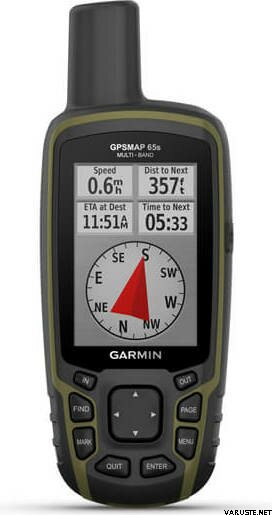
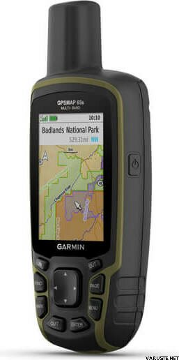
Garmin GPSMAP 65s is a rugged handheld GPS device that offers optimal tracking accuracy, a 2.6-inch colour display and preloaded maps! It also includes barometric altimeter and 3-axis compass that are missing from the GPSMAT 65 -version.
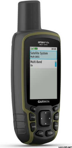
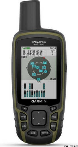
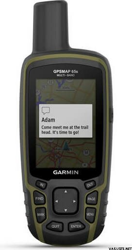
Multi-band technology and expanded GNSS support (GPS, GLONASS, Galileo, QZSS and IRNSS) provide optimal accuracy in steep country, urban canyons and forests with dense trees. Navigate every trail with ABC sensors, including an altimeter for elevation data, barometer to monitor weather and 3-axis electronic compass. Preloaded TopoActive Europe maps provide detailed views of routable street and off-road networks, waterways, natural features, land use areas, buildings and more. Receive emails, texts and alerts right on your handheld when paired with your compatible device. Using your compatible device and microSD memory card, conveniently download TOPO 24K maps and hit the trail. Get automatic cache updates from Geocaching Live, including descriptions, logs and hints. Plan, review and sync waypoints, routes and tracks by using the Garmin Explore app1 and website. You can even review completed activities while still in the field.
What's in the box:
General
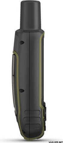
| Physical dimensions | 6,1 x 16,0 x 3,6 cm |
|---|---|
| Display size | 3.6 x 5.5 cm; 2.6-inch diagonal (6.6 cm) |
| Display resolution | 160 x 240 pixels |
| Display type | Transflective, 65K colour TFT |
| Weight | 217 g with batteries |
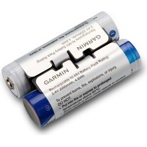
| Battery type | 2 AA batteries (not included); NiMH or Lithium recommended |
| Battery life | 16 hours |
| Water rating | IPX7 |
| High-sensitivity receiver | yes |
| Interface | High-speed mini USB and NMEA 0183 compatible |
| Memory/history | 16 GB (user space varies based on included mapping) |
Maps & memory
| Preloaded maps | Yes (TopoActive Europe; routable) |
|---|---|
| Map segments | 3 000 |
| Birdseye | 250 BirdsEye Imagery files |
| Storage and power capacity | Yes (32 GB max microSD™ card) |
| Waypoints/favourites/locations | 5 000 |
| Tracks | 200 |
| Track log | 10,000 points, 200 saved tracks |
| Routes | 200, 250 points per route; 50 points auto routing |
Sensors
Daily smart features
Outdoor recreation features
 Taiwan
| Overall rating | ☆☆☆☆☆ |
 — Show original
| Overall rating |
— Show originalQuite complicated to use. — Show originalA qualified device. I bought a broken 62 to replace it.
Works well in the forest and on a motorcycle.| Overall rating |
— Show originalHandy security check for trips in the North, and the route writing feature will definitely be used in other ways than lap. — Show originalMaps ok. GPS is more accurate, e.g. in weak field conditions, than with a phone. The screen is a bit small.| Overall rating |
— Show originalThe device is not as fast as a smartphone in terms of map loading speed or as intuitive to use, but it is reliable and easy to operate even when wearing thick gloves. Route planning is awkward, but possible with the device's own functions. I definitely recommend using a computer and some program (e.g. Garmin Basecamp or Caltopo) if you plan longer routes, and then transfer these routes to the device. The compass seems to point in the same direction as the traditional one and navigation with the device is easy. Garmin's TopoActive map doesn't do anything when moving in nature (all details down to height curves and paths are missing), but the accompanying MML map is very good. Of course, this doesn't support routing, so I downloaded an OSM-based terrain map from the internet, with which routing also works on top of the MML map. This uses a fair amount of power, so I recommend some kind of rechargeable batteries, I use Pale Blue AA lithium batteries.| Overall rating |
— Show originalThere is a ringing game with about a little hype. The previous GPS was also from Garmin, so the interface was familiar in that regard. Maps guaranteed by the National Land Survey of top quality.