Garmin
195 товарів




| Загальна оцінка | (70 відгуків) |
Rugged, Full-featured Handheld with GPS, GLONASS and Wireless Connectivity
2.6" sunlight-readable color screen
High-sensitivity GPS and GLONASS receiver with quad helix antenna
1-year BirdsEye Satellite Imagery subscription
3-axis compass with barometric altimeter
Wireless connectivity via Bluetooth® technology¹ or ANT+™
GPSMAP 64s
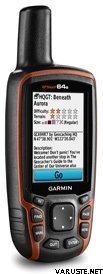
GPSMAP 64s features a 2.6” sunlight-readable color screen and a high-sensitivity GPS and GLONASS receiver with a quad helix antenna for superior reception. GPSMAP 64s includes a 3-axis electronic compass with barometric altimeter, wireless connectivity and a 1-year BirdsEye Satellite Imagery subscription.
Get Your Bearings
GPSMAP 64s has a built-in 3-axis tilt-compensated electronic compass, which shows your heading even when you’re standing still, without holding it level. Its barometric altimeter tracks changes in pressure to pinpoint your precise altitude, and you can even use it to plot barometric pressure over time, which can help you keep an eye on changing weather conditions.
Share Wirelessly
Share your waypoints, tracks, routes and geocaches wirelessly with other compatible devices. Your friends can enjoy your favorite hike or cache without waiting for you to plug in to your computer — simply press “send” to transfer your information to another Garmin handheld.
GPSMAP 64st also connects to compatible Garmin devices, including VIRB™ and accessory sensors, including tempe™, foot pod and heart rate monitor.
Stay Connected
With Smart Notification you can wirelessly receive email, texts and alerts from your compatible iPhone® 4s or later. Stay connected without having to dig into your backpack for your smartphone.
Explore the Terrain
GPSMAP 64s comes with a built-in worldwide basemap with shaded relief plus a 1-year BirdsEye Satellite Imagery subscription, so you can navigate anywhere with ease. With photo navigation, you can download geotagged pictures from the Internet and navigate to them.
Keep Your Fix
With its quad helix antenna and high-sensitivity, GPS and GLONASS, receiver, GPSMAP 64s locates your position quickly and precisely and maintains its location even in heavy cover and deep canyons. The advantage is clear — whether you’re in deep woods or just near tall buildings and trees, you can count on GPSMAP 64s to help you find your way when you need it the most.
Add Maps
GPSMAP 64s comes with a built-in worldwide basemap with shaded relief and a 1-year subscription of BirdsEye Satellite Imagery for a photo-realistic view. Adding more maps is easy with our array of detailed topographic, marine and road maps. With 4 GB of onboard memory and microSD™ card slot, you can conveniently download TOPO 24K and 100K maps and hit the trail, plug in BlueChart® g2 preloaded cards for a great day on the water or City Navigator NT® map data for turn-by-turn routing on roads (see maps tab for compatibility). In addition, the 64s is compatible with Garmin Custom Maps, a map format that allows you to transform paper and electronic maps easily into downloadable maps for your device, for free.
Find Fun
GPSMAP 64s supports paperless geocaching with 250,000 preloaded caches with hints and descriptions from Geocaching.com, and has a 16-hour battery life. By going paperless, you're not only helping the environment, but also improving efficiency. GPSMAP 64s stores and displays key information, including location, terrain, difficulty, hints and descriptions, which means there’s no more manually entering coordinates and paper printouts! Slim and lightweight, 64s is the perfect companion for all your outdoor pursuits.
Plan Your Next Trip
Take charge of your next adventure with BaseCamp™, software that lets you view and organize maps, waypoints, routes and tracks. This free trip-planning software even allows you to create Garmin Adventures that you can share with friends, family or fellow explorers. BaseCamp displays topographic map data in 2-D or 3-D on your computer screen, including contour lines and elevation profiles. It also can transfer an unlimited amount of satellite images to your device when paired with a BirdsEye Satellite Imagery subscription.
 Тайвань
| Загальна оцінка | ☆☆☆☆☆ |
 — Показати оригінал
 — Показати оригінал
Для мого першого GPS-пристрою було важко знайти в інструкції саме ту інструкцію, яка потрібна новачкові. На упаковці повністю відсутня інструкція фінською мовою, а для її пошуку в Інтернеті потрібне підключення до Інтернету та навички, які мало хто з збирачів ягід старше 70 років має без допомоги молодших людей. Це означає, що для користування пристроєм у лісі потрібен помічник.| Загальна оцінка |
— Показати оригіналЦе подарунок моїй сестрі за її обов'язки рятувальника собаки. Кажуть, що він хороший. Цей гаджет також був включений до нашого спільного походу в Хаммастунтурі, і там виявилося, що він працює всюди. Лише одного разу на перехресті стежки ми помітили, що він показував місцезнаходження приблизно на 100 метрів неправильно, але в іншому випадку він, здається, завжди показував абсолютно правильне місцезнаходження. — Показати оригіналВідносно простий у використанні, швидко заряджається, іноді на бортовому комп'ютері з'являються дивні показники пробігу, хоча ви проїхали лише кілька сотень метрів| Загальна оцінка |
— Показати оригіналГарний та базовий надійний пристрій. Я купив його як навігаційний пристрій для гідроцикла, тому мені довелося витратити ще +150 євро на сумісні карти водних зон та кріплення. Працює як треба, і сигнал не падає без потреби. Водонепроникний. Можна використовувати з батарейками типу АА або NiMH та легко працює цілий день на одному заряді, навіть при повній яскравості екрана.
Гарне співвідношення ціни та якості.| Загальна оцінка |
— Показати оригіналІнструкція також мала бути фінською мовою. Універсальна, надійна. — Показати оригіналДосить непоганий пакет, хоча наразі він не дуже корисний| Загальна оцінка |
— Показати оригіналЄдиний пристрій для використання на вулиці, акумулятор якого працює цілий день. Можна використовувати навіть у рукавичках. Оновлення екрана на карті, що входить до комплекту, трохи повільне. Система меню була кращою в попередніх моделях.| Загальна оцінка |
— Показати оригіналЦе спрацювало добре, але в мене ще не було багато часу, щоб вийти в поле.| Загальна оцінка |
— Показати оригіналЗручний та точний GPS для геокешингу. Працює як влітку, так і взимку в морози, оскільки пристрій має кнопки.
Немає потреби в попередньо завантажених традиційних програмах, просто видаліть їх разом із непотрібними папками та завантажте gpx-файли та карти місцевості, така чудова гра.