Garmin
195 produtos




| Classificação geral | (70 avaliações) |
Rugged, Full-featured Handheld with GPS, GLONASS and Wireless Connectivity
2.6" sunlight-readable color screen
High-sensitivity GPS and GLONASS receiver with quad helix antenna
1-year BirdsEye Satellite Imagery subscription
3-axis compass with barometric altimeter
Wireless connectivity via Bluetooth® technology¹ or ANT+™
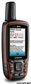
GPSMAP 64s
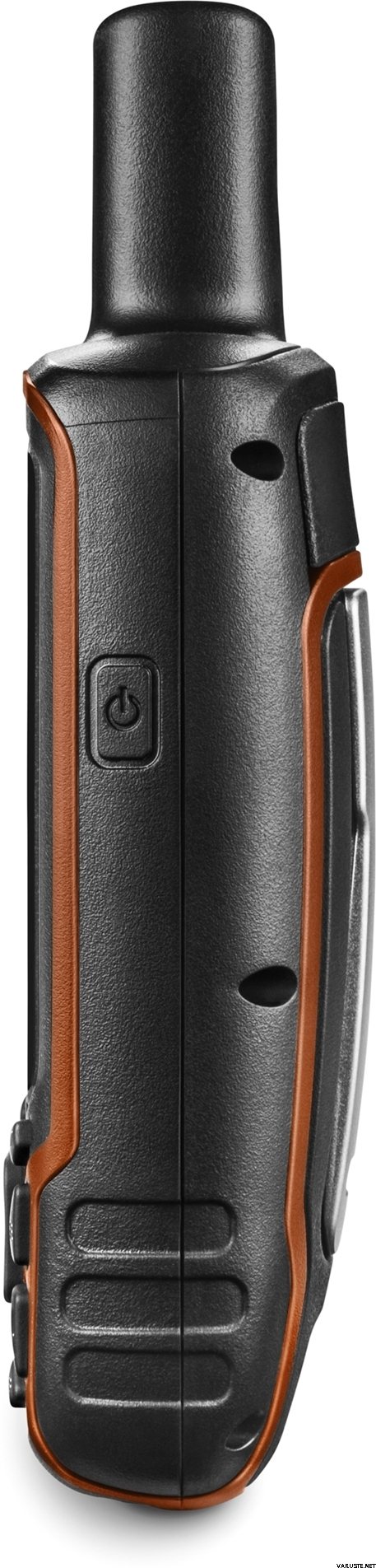
GPSMAP 64s features a 2.6” sunlight-readable color screen and a high-sensitivity GPS and GLONASS receiver with a quad helix antenna for superior reception. GPSMAP 64s includes a 3-axis electronic compass with barometric altimeter, wireless connectivity and a 1-year BirdsEye Satellite Imagery subscription.
Get Your Bearings
GPSMAP 64s has a built-in 3-axis tilt-compensated electronic compass, which shows your heading even when you’re standing still, without holding it level. Its barometric altimeter tracks changes in pressure to pinpoint your precise altitude, and you can even use it to plot barometric pressure over time, which can help you keep an eye on changing weather conditions.
Share Wirelessly
Share your waypoints, tracks, routes and geocaches wirelessly with other compatible devices. Your friends can enjoy your favorite hike or cache without waiting for you to plug in to your computer — simply press “send” to transfer your information to another Garmin handheld.
GPSMAP 64st also connects to compatible Garmin devices, including VIRB™ and accessory sensors, including tempe™, foot pod and heart rate monitor.
Stay Connected
With Smart Notification you can wirelessly receive email, texts and alerts from your compatible iPhone® 4s or later. Stay connected without having to dig into your backpack for your smartphone.
Explore the Terrain
GPSMAP 64s comes with a built-in worldwide basemap with shaded relief plus a 1-year BirdsEye Satellite Imagery subscription, so you can navigate anywhere with ease. With photo navigation, you can download geotagged pictures from the Internet and navigate to them.
Keep Your Fix
With its quad helix antenna and high-sensitivity, GPS and GLONASS, receiver, GPSMAP 64s locates your position quickly and precisely and maintains its location even in heavy cover and deep canyons. The advantage is clear — whether you’re in deep woods or just near tall buildings and trees, you can count on GPSMAP 64s to help you find your way when you need it the most.
Add Maps
GPSMAP 64s comes with a built-in worldwide basemap with shaded relief and a 1-year subscription of BirdsEye Satellite Imagery for a photo-realistic view. Adding more maps is easy with our array of detailed topographic, marine and road maps. With 4 GB of onboard memory and microSD™ card slot, you can conveniently download TOPO 24K and 100K maps and hit the trail, plug in BlueChart® g2 preloaded cards for a great day on the water or City Navigator NT® map data for turn-by-turn routing on roads (see maps tab for compatibility). In addition, the 64s is compatible with Garmin Custom Maps, a map format that allows you to transform paper and electronic maps easily into downloadable maps for your device, for free.
Find Fun
GPSMAP 64s supports paperless geocaching with 250,000 preloaded caches with hints and descriptions from Geocaching.com, and has a 16-hour battery life. By going paperless, you're not only helping the environment, but also improving efficiency. GPSMAP 64s stores and displays key information, including location, terrain, difficulty, hints and descriptions, which means there’s no more manually entering coordinates and paper printouts! Slim and lightweight, 64s is the perfect companion for all your outdoor pursuits.
Plan Your Next Trip
Take charge of your next adventure with BaseCamp™, software that lets you view and organize maps, waypoints, routes and tracks. This free trip-planning software even allows you to create Garmin Adventures that you can share with friends, family or fellow explorers. BaseCamp displays topographic map data in 2-D or 3-D on your computer screen, including contour lines and elevation profiles. It also can transfer an unlimited amount of satellite images to your device when paired with a BirdsEye Satellite Imagery subscription.
 Taiwan
| Classificação geral | ☆☆☆☆☆ |
 — Mostrar o original
 — Mostrar o original
Para o meu primeiro dispositivo GPS, tem sido difícil encontrar as instruções exatas que um iniciante precisa no manual. A embalagem não contém instruções em finlandês, e encontrá-las online exige conexão com a internet e habilidades que poucos colhedores de frutos silvestres com mais de 70 anos possuem sem a ajuda de pessoas mais jovens. Isso significa que você precisa de um assistente para usar o dispositivo na floresta.| Classificação geral |
— Mostrar o originalRecebi este produto como presente para minha irmã, devido ao seu trabalho com cães de resgate. Ela disse que é bom. O dispositivo também foi usado em nossa caminhada conjunta por Hammastunturi e constatamos que funciona em qualquer lugar. Apenas uma vez, em uma bifurcação da trilha, percebemos que ele indicava a localização com uma margem de erro de cerca de 100 metros, mas, fora isso, sempre mostrou a localização exata. — Mostrar o originalRelativamente fácil de usar, carrega rapidamente, mas às vezes aparecem leituras estranhas de quilometragem no computador de bordo, mesmo que você tenha percorrido apenas algumas centenas de metros.| Classificação geral |
— Mostrar o originalBom dispositivo básico e confiável.
Comprei-o como dispositivo de navegação para um jet ski, então tive que investir mais de 150 euros em mapas aquáticos compatíveis e um suporte.
Funciona como deveria e o sinal não cai desnecessariamente. À prova d'água.
Pode ser usado com pilhas AA ou NiMH e dura facilmente o dia todo com uma única carga, mesmo com o brilho da tela no máximo.
Boa relação custo-benefício.| Classificação geral |
— Mostrar o originalAs instruções também deveriam estar em finlandês. Versátil e confiável. — Mostrar o originalPacote bastante bom, embora não seja muito útil neste momento.| Classificação geral |
— Mostrar o originalO único dispositivo para uso externo cuja bateria dura o dia todo. Pode ser usado até mesmo com luvas. As atualizações da tela são um pouco lentas no mapa incluído. O sistema de menus era melhor em modelos anteriores.| Classificação geral |
— Mostrar o originalTem funcionado bem, mas ainda não tive muito tempo para ir a campo.| Classificação geral |
— Mostrar o originalGPS prático e preciso para geocaching. Funciona no verão e nas geadas de inverno, pois o dispositivo possui botões.
Não há necessidade de instalar aqueles aplicativos tradicionais pré-instalados, basta excluí-los com suas pastas desnecessárias e baixar arquivos GPX e mapas de terreno. É uma ótima opção para jogos.