DisponibilidadeEste produto não está à venda de momento.
Disponibilidade detalhada
Avaliações
Descrição do produto
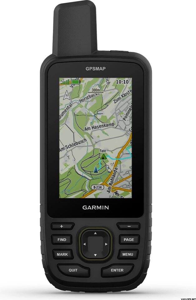
Make more time for adventure with this premium, rugged handheld. Get long battery life and multi-band technology for enhanced accuracy plus preloaded TopoActive maps and access to satellite imagery.
- See your route clearly on the 3” sunlight-readable color display
- Travel longer with up to 180 hours of battery life in GPS mode and up to 840 hours in expedition mode
- Track your position in challenging conditions with multi-band technology and expanded GNSS support
- See the terrain you’ll travel with vivid satellite imagery that downloads right to your navigator
- Stay tuned to the forecast with active weather on your route when paired to your compatible smartphone
- Access multiple global navigation satellite systems (GPS, GLONASS, Galileo and QZSS). Get access to multiple frequencies sent by navigation satellites for improved position accuracy in areas where GNSS signals are reflected, weak or typically don't penetrate
- Navigate every trail with ABC sensors, including an altimeter for elevation data, barometer to monitor weather and 3-axis electronic compass.
- Download high-resolution photorealistic maps directly to your device via Wi-Fi® technology. Easily find trails, pick stand locations and parking, create waypoints and more
- Preloaded TopoActive U.S., Mexico and Canada maps show you terrain contours, topographic elevations, summits, parks, coastlines, rivers, lakes and geographical points
- With an Outdoor Maps+ subscription, you get public land information, landowner names, state plat maps, hunting management unit boundaries, BLM boundaries and more
Includes
GPSMAP 67i
Type A to Type C USB cable
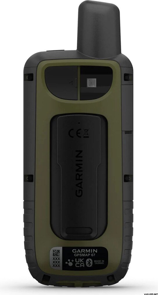
Carabiner clip
Documentation
General
|
Dimension
|
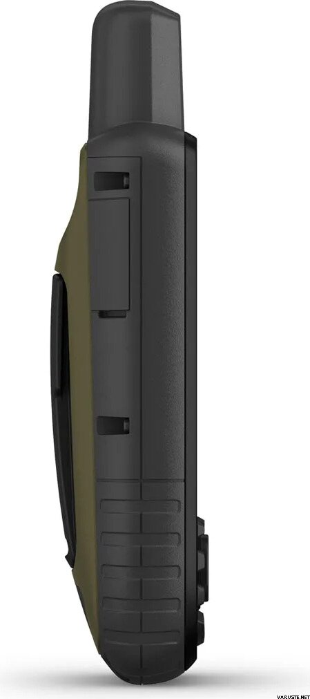
2.5” x 6.4” x 1.4” (6.2 x 16.3 x 3.5 cm)
|
|
Display size
|
1.5"W x 2.5"H (3.8 x 6.3 cm); 3" diag (7.6 cm)
|
|
Display resolution
|
240 x 400 pixels
|
|
Display type
|
Transflective color TFT
|
|
Weight
|
8.1 oz (230 g) with batteries
|
|
Waterproof
|
IPX7
|
|
Battery type
|
Rechargeable, internal lithium-ion
|
|
Battery life
|
Up to 180 hours in default mode
Up to 840 hours in expedition mode
|
|
MIL-STD-810
|
Yes (thermal, shock, water); bare unit only
|
|
Interface
|
USB-C
|
|
Memory/history
|
16 GB (user space varies based on included mapping)
|
|
Preloaded maps
|
Yes (TopoActive, routable)
|
|
Ability to add maps
|
Yes
|
|
Basemap
|
Yes
|
|
Automatic routing (turn by turn routing on roads) for outdoor activities
|
Yes
|
|
Map segments
|
15,000
|
|
Satellite imagery
|
Yes (direct to device)
|
|
Includes detailed hydrographic features (coastlines, lake/river shorelines, wetlands and perennial and seasonal streams)
|
Yes
|
|
Includes searchable points of interests (parks, campgrounds, scenic lookouts and picnic sites)
|
Yes
|
|
Displays national, state and local parks, forests, and wilderness areas
|
Yes
|
|
External memory storage
|
Yes (32 GB max microSD card)
|
|
Waypoints/favorites/locations
|
10,000
|
|
Courses
|
250, 200 course points per course
|
|
Tracks
|
250
|
|
Navigation track log
|
20,000 points, 250 saved gpx tracks, 300 saved fit activities
|
|
Activities
|
Yes
|
|
Navigation routes
|
250, 250 points per route; 50 points auto routing
|
|
Rinex logging
|
Yes
|
|
High-sensitivity receiver
|
Yes
|
|
GPS
|
Yes
|
|
Glonass
|
Yes
|
|
Galileo
|
Yes
|
|
QZSS
|
Yes
|
|
Beidou
|
Yes
|
|
IRNSS
|
Yes
|
|
Barometric altimeter
|
Yes
|
|
Compass
|
Yes (tilt-compensated 3-axis)
|
|
GPS compass (while moving)
|
Yes
|
|
Multi-band frequency support
|
Yes
|
|
Connect IQ (downloadable watch faces, data fields, widgets and apps)
|
Yes
|
|
Smart notifications on handheld
|
Yes
|
|
VIRB remote
|
Yes
|
|
Pairs with Garmin Connect mobile
|
Yes
|
|
Active weather
|
Yes
|
|
Point-to-point navigation
|
Yes
|
|
Tracback
|
Yes
|
|
Area calculation
|
Yes
|
|
Hunt/fish calendar
|
Yes
|
|
Sun and moon information
|
Yes
|
|
Xero locations
|
Yes
|
|
Geocaching-friendly
|
Yes (Geocache Live)
|
|
Custom maps compatible
|
Yes (500 custom map tiles)
|
|
Picture viewer
|
Yes
|
|
Led beacon flashlight
|
Yes
|
|
Livetrack
|
Yes
|
|
Inreach remote compatible
|
Yes
|
|
Compatible with Garmin Explore app
|
Yes
|
|
Garmin Explore website compatible
|
Yes
|
|
Connections wireless connectivity
|
Yes (Wi-Fi, BLUETOOTH, ANT+)
|
O tamanho do produto embalado ou da embalagem de venda é aproximadamente 200 x 150 x 150 mm.
Este produto só é entregue com estes métodos de entrega:- Levantamento na nossa loja
- Carta com seguimento
- Entrega à porta à hora combinada (Matkahuolto Kotijakelu)
- Entrega à porta à hora combinada (Posti contentor com rodas)
- Entrega à porta à hora combinada (Posti europalete)
- Entrega à porta à hora combinada (Posti Home Parcel)
- Entrega à porta (Matkahuolto Jakopaketti)
- Entrega à porta (Posti)
- Entrega à porta (Posti contentor com rodas, durante o horário de trabalho)
- Entrega à porta (Posti europalete, durante o horário de trabalho)
- Entrega à porta (Posti manhã)
- Entrega à porta (Posti palete especial)
- Entrega expresso até à morada (DHL Express Worldwide)
- Levantamento em cacifo de encomendas (Posti)
- Levantamento em cacifo de encomendas (PostNord)
- Levantamento em ponto de encomendas (Matkahuolto)
- Levantamento em ponto de encomendas Posti
- Levantamento em ponto de encomendas (PostNord)
- Levantamento em ponto de encomendas R-kioski ou K-Market (DB Schenker)
- Posti freight to doorstep
24 meses
País de origem
Taiwan
ComentáriosAdicionar comentário
Marca