
Garmin
196 produkter


| Genrell vurdering | (6 vurderinger) |
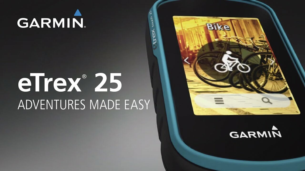
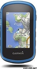
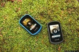
Color Touchscreen GPS/GLONASS Handheld with 3-axis Compass
Compact rugged and reliable GPS/GLONASS handheld with color touchscreen, featuring a 3-axis tilt compensated electronic compass, wireless connectivity, preloaded geocaches and expanded internal memory to hold more maps.
See the Way
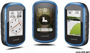
eTrex Touch 25 features a sunlight readable, 2.6-inch color touchscreen display offering intuitive access to worldwide basemap with shaded relief. Durable and waterproof, eTrex Touch 25 is built to keep delivering vital mapping and tracking data no matter what the elements throw at you, standing strong against dust, dirt, humidity and water.
New Tools for Your Trek
eTrex Touch 25 features a built-in 3-axis tilt-compensated electronic compass that shows your heading even when you’re standing still, and you don’t have to hold it level to get an easy-to-understand display of your heading.
Go Anywhere
With an array of compatible mounts, eTrex Touch 25 is designed for use on ATVs, bicycles, boats, as a handheld or in your car. Wherever you think you might take eTrex, it has the mapping and mounts to get you there.
Go Global
eTrex Touch 25 can track both GPS and GLONASS satellites simultaneously. Developed by the Russian Federation, GLONASS satellites “lock on” to a position (on average) faster than GPS receivers. Using both GPS and GLONASS means the receiver has the ability to lock on to 24 more satellites than using GPS alone.
Add Maps
With its microSD™ card slot and a full 4 GB of internal memory, eTrex Touch 25 lets you load TOPO maps and hit the trail, plug in BlueChart® g2 preloaded cards for a great day on the water or City Navigator® NT map data for turn-by-turn routing on roads. eTrex Touch 25 also supports BirdsEye Satellite Imagery (subscription required) that lets you download satellite images to your device and integrate them with your maps.
Find Fun
eTrex Touch 25 is preloaded with 250,000 geocaches from Geocaching.com. By going paperless, you're not only helping the environment but also improving efficiency. eTrex Touch 25 stores and displays key information, including location, terrain, difficulty, hints and descriptions, which means no more manually entering coordinates and paper printouts. Simply upload the GPX file to your unit and start hunting for geocaches.
Plan Your Next Trip
Take charge of your next adventure with BaseCamp™, software that lets you view and organize maps, waypoints, routes and tracks. This free trip-planning software even allows you to create Garmin Adventures that you can share with friends, family or fellow explorers. BaseCamp displays topographic map data in 2-D or 3-D on your computer screen, including contour lines and elevation profiles. It also can transfer an unlimited amount of satellite images to your device when paired with a BirdsEye Satellite Imagery subscription.
Physical & Performance
Physical dimensions2.3” x 4.0” x 1.3” (5.8 x 10.2 x 3.3 cm)
Display size, WxH1.43" x 2.15" (3.6 x 5.5 cm)
Display resolution, WxH160 x 240 pixels
Display type2.6" 65K color TFT
Touchscreen
Weight5.6 oz (159 g) with batteries
Battery2 AA batteries (not included); NiMH or Lithium recommended
Battery lifeUp to 16 hours
Water ratingIPX7
High-sensitivity receiver
InterfaceUSB
Electronic compass
Maps & Memory
Basemap
Ability to add maps
Built-in memory4GB
Accepts data cardsmicroSD™ card (not included)
Custom POIs (ability to add additional points of interest)
Waypoints/favorites/locations4000
Routes200
Track log10,000 points, 200 saved tracks
Outdoor Features
Automatic routing (turn by turn routing on roads)Yes (with optional mapping for detailed roads)
Geocaching-friendlyYes (Paperless)
Custom maps compatible
Sun and moon information
Tide tablesYes (with optional Bluechart)
Area calculation
Picture viewer
Garmin Connect™
Garmin Connect™ compatible (online community where you analyze, categorize and share data)
 Taiwan
| Genrell vurdering | ☆☆☆☆☆ |
 — Vis original
| Genrell vurdering |
— Vis originalEn passel enhet, hvis ikke savner veldig mange funksjoner for sykkelnavigasjon. Et stort pluss for utskiftbare batterier| Genrell vurdering |
— Vis originalLiten, lett, holdbar. Absolutt når du passerer dine egne veier. En valgfri ryggsekkbinding er bra.| Genrell vurdering |
— Vis originalEn veldig vanskelig enhet i stil med Garmin. Berøringsskjermen fungerer ikke i frost. — Vis originalEnheten har ikke samme brukervennlighet som min forrige Garmin Dakota 20. Enhetene er priset det samme.
En mer robust versjon av Dakota 20. Vis dårligere, oppløsningen kan være bedre (klonass), mer tungvint og treg å bruke.| Genrell vurdering |
— Vis originalEn god enhet vil dekke mine behov. — Vis originalJa, dette er også geocaching. Kanskje det starter sakte hvis det gjør vondt for noen nå. Grensesnittet er på en eller annen måte forvirrende med i det minste lite brukeropplevelse.