Sporten‪» Buitenactiviteiten‪» Elektronica‪» Gps-toestellen‪» Hiking GPS‪»

Garmin GPSmap 64x

Garmin GPSmap 64x

Garmin GPSmap 64x
Garmin GPSmap 64x
Garmin GPSmap 64x
Garmin GPSmap 64x
Garmin GPSmap 64x
Garmin GPSmap 64x
Garmin GPSmap 64x
Garmin GPSmap 64x

Prijs
299,00 + verzendkosten
Incl. btw 24 %


Aantal
stuk


Winkel (Helsinki)op het schap0 stuks
Online op voorraad0 stuks

Productcode
010-02258-01
Barcode
753759229474

Ook bekijken
Map
National Land Survey Of Finland: Electronic Map of Finland in microSD
+25,00 €


U kunt maximaal het aantal producten bestellen, dat wij op voorraad hebben.
Beschikbaarheid
Ongeveer 2 - 9 dag(en) van de bestelling. De betrouwbaarheid van de schatting is vrij goed.

Aantal voorraad
Ik ontvang graag een notificatie wanneer dit product weer op voorraad is.


Recensies
Algemene waardering ()


Productomschrijving

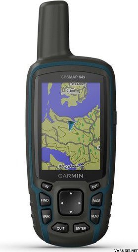
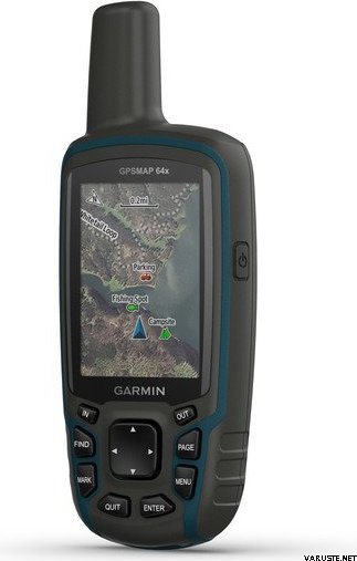
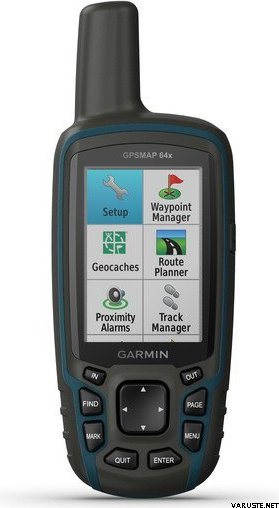
Explore the world with reliable navigation in hand. Navigate your next adventure with the GPSMAP 64x handheld navigator series. Whether you’re hiking, cycling, geocaching or climbing, you are free to explore more with the best-in-class Garmin handheld navigation in the palm of your hand. And the series now has multi-GNSS support, too.
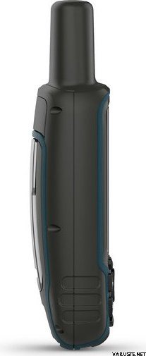
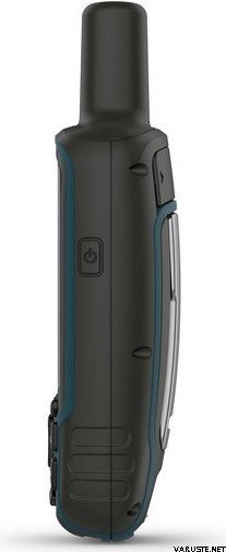
  • Rugged and water-resistant design with button operation and a 2.6" sunlight-readable colour display
  • Know where you're at with a high-sensitivity receiver with quad helix antenna and multi-GNSS support (GPS, GLONASS and Galileo), and 3-axis compass with barometric altimeter available on GPSMAP 64sx models
  • Wireless connectivity via Bluetooth® and ANT+® technology available on GPSMAP 64sx models
  • Battery life: up to 16 hours in GPS mode
With its quad helix antenna, high-sensitivity receiver and multiple global navigation systems support (GPS, GLONASS and Galileo), the GPSMAP 64x series locates your position quickly and precisely, and maintains its location in more challenging environments than GPS alone.

With 8 GB of onboard memory and a microSD™ card slot for expandable storage, you can conveniently download even more maps.

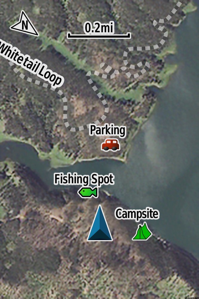
The GPSMAP 64x series also supports BirdsEye Satellite Imagery (subscription required) that lets you load satellite images and integrate them with your maps.

GPSMAP 64sx handhelds let you share your waypoints, tracks, routes and geocaches wirelessly with other compatible devices. Your friends can enjoy your favourite hike or cache without waiting for you to plug in to your computer; simply press "send" to transfer your information to another Garmin handheld.

With smart notifications, you can wirelessly receive emails, texts and alerts from your compatible device. Stay connected without having to dig into your backpack for your smartphone.

The GPSMAP 64x series features paperless geocaching. Upload GPX files straight to your device, and view key information such as location, terrain and hints from Geocaching.com.

General

Physical dimensions 6.1 x 16.0 x 3.6 cm
Display size 3.6 x 5.5 cm; 2.6" diag (6.6 cm)
Display resolution 160 x 240 pixels
Display type Transflective, 65K colour TFT
Weight 230 g with batteries
Battery 2 AA batteries (not included); NiMH or Lithium recommended
Battery life 16 hours
Water rating IPX7
Memory/history 8 GB
High-sensitivity receiver
Interface USB and NMEA 0183 compatible

Maps & memory

Ability to add maps
Basemap
Storage and power capacity microSD™ card (not included)
Waypoints/favourites/locations 5,000
Routes 200
Track log 10,000 points, 200 saved tracks
Outdoor recreation features
Area calculation
Automatic routing (turn by turn routing on roads) Yes (with optional mapping for detailed roads)
Geocaching-friendly Yes (Paperless)
Custom maps compatible
Hunt/fish calendar
Sun and moon information
Picture viewer
Garmin Connect™
Garmin Connect™ compatible (online community where you analyse, categorise and share data)

Additional

GPS: Yes
GLONASS: Yes
Galileo: Yes

In the box:
  • GPSMAP 64x
  • Charging/data cable
  • Documentation


De afmeting van het verpakte product of de verpakking is ongeveer 60 x 160 x 180 mm.


Barometrische hoogtemeter
Nee


Battery life max (h)
16


Geschikt voor geocaching
Ja


IP Classification
IPX7


Resolutie van het beeldscherm
160 x 240


Satellietcommunicatie
Nee


Screen size (inches)
2,6


Gewicht
0,35 kg


Garantie
24 maand(en)


Land van oorsprong
Taiwan


Commentaren
Anoniem geverifieerde koper, 10.9.2020
Algemene waardering
Vertaald door GoogleOrigineel weergeven
De interface is waarschijnlijk ontworpen door een landmeetkundige ingenieur, het werkt, maar verwarrend. Ja, er is een moment om te leren. Anders een goed pakket en betrouwbaar.
Juho J. geverifieerde koper, 5.5.2020
Algemene waardering
Vertaald door GoogleOrigineel weergeven
Is goed
Lea S. geverifieerde koper, 4.2.2020
Algemene waardering
Vertaald door GoogleOrigineel weergeven
Het zou leuk geweest zijn als de sim van de kaarten al in de geps was gezet. Lea Silto
Markus S. geverifieerde koper, 18.1.2020
Algemene waardering
Vertaald door GoogleOrigineel weergeven
Correct gekwalificeerd apparaat in gebruik, dit is nu in de lokale omgeving getest. Het lijkt een erg bomvrije kast. De logica van de actie is in eerste instantie onbegrijpelijk voor onervaren en meestal gewend aan de mobiele telefoon, maar hij opent zich wanneer zijn tijd zijn hoofd heeft geschud in een dennenboom. Er is ruimte voor verbetering in de documentatie (voornamelijk basisconcepten en navigatielogica). De levensduur van de batterij moet tijdens een skitocht onder veldomstandigheden worden getest.
Profielnaam Kosketus 19.9.2019
Vertaald door GoogleOrigineel weergeven
Echter, zoals de technische gegevens zeggen: "Schermtype: Transflectief 65.000 kleuren TFT-touchscreen"
Hanna H. 2.10.2019
Hallo, Ja, dat aanraakscherm lijkt te zijn. :) Hier is een link naar de website van de fabrikant: https://buy.garmin.com/en-US/EN/p/669282#specs
Een commentaar leveren

Merk


Garmin GPSMAP 64x Series: Reliable Navigation in Hand

Producten, die vaak gekocht zijn met dit product:


Blog

Hanki esiladattu kartta-aineisto mukaan muistikorttipaikkaisiin Garmin-laitteisiin

Myymme muistikorttipaikkaisiin Garmin GPS-laitteisiin microSD-korttia, johon on esiladattu Maanmittauslaitoksen kartta-aineiston pohjalta laadittu maastokartta (Tekijä on Teemu Peltonen. Lisensoitu Creative Commons Nimeä-Ei muutoksia-Epäkaupallinen 4.0 Muokkaamaton -lisenssillä.)...