Lonely Planet New Orleans City Map

Lonely Planet New Orleans City Map


Promotieprijs
5,52 + verzendkosten
De offerte blijft geldig nog
Normale prijs 6,90 €
Incl. btw 24 %


Aantal
stuk


Winkel (Helsinki)op het schap0 stuks
Online op voorraad0 stuks


U kunt maximaal het aantal producten bestellen, dat wij op voorraad hebben.
Beschikbaarheid
Dit product is momenteel niet verkrijgbaar.

Aantal voorraad


Productomschrijving
1st Edition Jan 2017

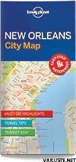
Durable and waterproof, with a handy slipcase and an easy-fold format, Lonely Planet New Orleans City Map is your conveniently-sized passport to traveling with ease.

Get more from your map and your trip with images and information about top city attractions, walking tour routes, transport maps, itinerary suggestions, extensive street and site index, and practical travel tips and directory.

With this easy-to-use, full color navigation tool in your back pocket, you can truly get to the heart of New Orleans, so begin your journey now!

  • Durable and waterproof
  • Easy-fold format and convenient size
  • Handy slipcase
  • Full color and easy-to-use
  • Extensive street and site index
  • Images and information about top city attractions
  • Handy transport maps
  • Walking tour routes
  • Practical travel tips and directory
  • Itinerary suggestions

Covers: French Quarter, Faubourg Maurigny, Bywater, CBD, Warehouse District, Garden, Lower Garden, Central City, Uptown, Riverbend, Mid-City, the Tremé


ISBN: 9781786575067 Language: English

Authors: Lonely Planet Publications

2 pages, 2 pp colour | Dimensions: 95mm x 197mm

Next edition due: Jan 2020


De afmeting van het verpakte product of de verpakking is ongeveer 197 x 95 x 20 mm.


Waterbestendig
Nee


Gewicht
0,05 kg


Commentaren
Een commentaar leveren

Merk