
Garmin
192 prodotti


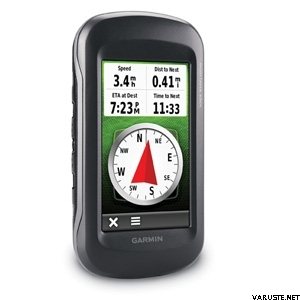
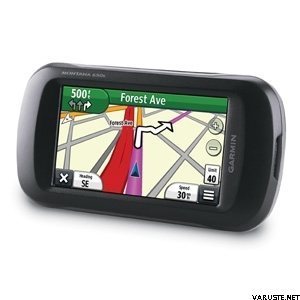
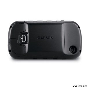

Now there’s one handheld GPS for three very different activities. Whether you're on foot, on the road or on water, the new Montana 650t from Garmin will guide you wherever you go. With a vast 4” sunlight-readable touchscreen that offers crystal clear enhanced colours, dual orientation display and high sensitivity HotFix® positioning to track your location, it’s easy to see where you are at all times. Both durable and waterproof, Montana 650t is built to withstand the elements.
The Montana has key features for the outdoors such as a 3-axis tilt-compensated compass which shows your heading even when you’re standing still, without holding it level. It also has a barometric altimeter which tracks changes in pressure to pinpoint your precise altitude, and you can even use it to plot barometric pressure over time, which can help you keep an eye on changing weather conditions.
It is also preloaded with European recreational mapping with detail including national, state and local parks and forests, along with terrain contours, elevation information, trails, rivers, lakes and points of interest. Just in case you’re wondering how steep that hill really is, Montana’s 3-D map view helps you visualise your surroundings, giving you a better perspective of the elevation.
Capture locations and memories with Montana 650t’s 5-megapixel digital camera. Each photo is automatically geotagged with the location of where it was taken, allowing you to navigate back to that exact spot in the future. To keep track of your photos and show their location on a map, simply connect Montana 650t via USB and use Garmin’s free BaseCamp™ software.
Mapping options include the City Navigator maps for use in the car, BlueChart® g2 preloaded cards for a great day on the water, Garmin GB Discoverer™ which provides Ordnance Survey mapping on your handheld and BirdsEye™ Select that lets you download customised sections of premium raster-based maps to your device and integrate them with your maps. Montana is also compatible with Custom Maps which transforms paper and electronic maps into downloadable maps for your device.
With Montana 650t you can share your waypoints, tracks, routes and geocaches wirelessly with other compatible Garmin GPS users. So now your friends can also enjoy your favourite hike or cache – simply press “Send” to transfer your information to other units.
Montana 650t supports geocaching GPX files to download geocaches and details straight to your unit. Visit OpenCaching.com to start your geocaching adventure. Montana 650t stores and displays key information, such as location, terrain, difficulty, hints and descriptions, which means no more manually entering coordinates and paper print outs! Simply upload the GPX file to your unit and start hunting for caches.
The Montana is the ultimate take-anywhere navigator for the serious adventurer.
Maanmittauslaitoksen avoimen tietoaineiston lisenssi
 — Mostra originale
 — Mostra originale
Posso scaricarlo tramite usb anche con un pannello solare?