Sports‪» Trekking‪» Maps‪» Maps of Finland‪» Outdoor Maps‪»

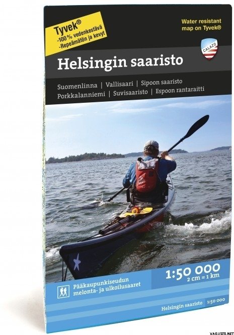
Calazo Helsingin saaristo

Calazo Helsingin saaristo

Calazo Helsingin saaristo

Price
18,90 + delivery costs
Incl. VAT 25.5 %


Quantity
pc


Available in stock
Store (Helsinki)on-shelf4 pcs immediately
Available in the webstore4 pcs immediately

Availability
Immediately

Detailed availability

Location Store (Helsinki): Trekking, 11


Reviews
Overall rating ()


Product description
Translated by GoogleShow original

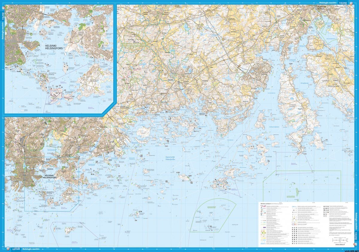
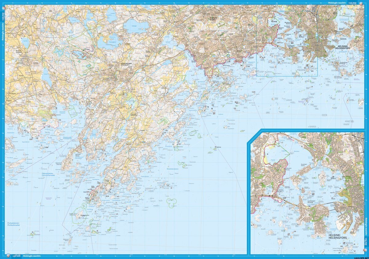
Scale: 1:50,000

ISBN: 978-91-86773-49-6

The coast of the capital region with its islands is a unique excursion area all year round. Water buses take you to popular outdoor islands in Helsinki and neighboring municipalities. With this map, you can also paddle and skate in the Kirkkonummi, Espoo and Sipoo archipelagos, as well as hike on Espoo's Rantarait.

Our maps cover the most popular hiking areas in our country, from Nuuksio to Kilpisjärvi. The ground material is supplied by the Land Survey and Metsähallitus. The maps have been updated with routes, huts and other camping services, as well as the region's tourism services.

One map can fit a huge area, because we print on both sides of the maps. Thanks to the clever division of the pages, you usually only need one map on your hike, which also has many day trip destinations.

We depict the steep slopes of fells and large hills with slope shading, which makes it easier to read the map.


The scale is 1:25,000 and 1:50,000, so they hold a lot of information.


The maps are made of water-resistant and tear-resistant Tyvek material, which is lighter than paper. You can stuff the map in your pocket and you don't have to protect it from the rain.


The approximate size of the packed product or the sales package is 150 x 100 x 20 mm.


Waterproof
Yes


Weight
0,08 kg


Comments
Customer service person Nina E. verified buyer, 13.9.2024
Translated by GoogleShow original
Good map. Works without a map pocket even on the deck of a kayak in pouring rain.
Niko S. verified buyer, 15.7.2020
Overall rating
Translated by GoogleShow original
Good map for route planning and generous planning, for more accurate navigation the map resolution is not enough (scale 1: 50000). Outdoor island services (fireplaces, harbors, tent sites, etc.) well featured.
Anonymous verified buyer, 16.4.2020
Overall rating
Translated by GoogleShow original
I got the wrong map, so I can't judge.
Vesa L. verified buyer, 4.9.2018
Translated by GoogleShow original
Quite a functional map of the waters

Add a comment

Brand


Products that have often been purchased with this product:


Blog

Varustelista retkelle

Alla esimerkkilistausta, josta voi helposti tsekkailla että mitä kaikkea voi / kannattaa ottaa retkelle mukaan. Varusteiden määrä riippuu kovasti, että minkä pituista retkeä ollaan suunnittelemassa ja millaisiin olosuhteisiin, mutta laatimamme lista on sen verran kattava, että...