Garmin
195 προϊόντα


| Συνολική βαθμολογία | (2 αξιολογήσεις) |
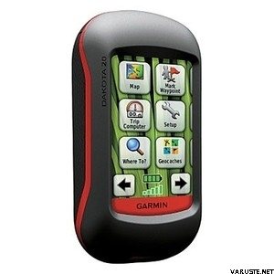
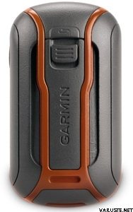
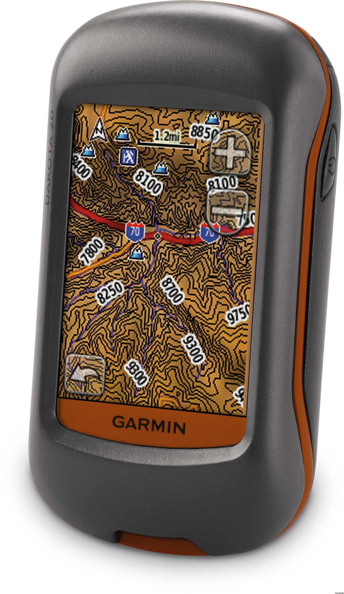
Outdoor navigation meets touchscreen simplicity in Dakota 20. This rugged, palm-sized navigator combines touchscreen navigation, high-sensitivity GPS with HotFix™ satellite prediction, barometric altimeter, 3-axis electronic compass and microSD™ card slot in one affordable, power-packed punch.
Touch and Go
Dakota 20 makes outdoor navigation effortless with a tough, sunlight-readable, 2.6 inch color touchscreen display. The interface is easy to use, so you’ll spend more time enjoying the outdoors and less time searching for information. Both durable and waterproof, Dakota 20 is built to withstand the elements: bumps, dust, dirt and water are no match for this rugged navigator.
Get Your Bearings
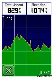
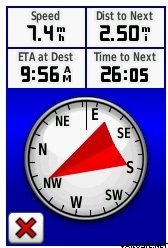
Dakota 20 has a built-in 3-axis electronic compass, which shows your heading even when you’re standing still or not holding the device level. Its barometric altimeter tracks changes in pressure to pinpoint your precise altitude, and you can even use it to plot barometric pressure over time, which can help you keep an eye on changing weather conditions. And with its high-sensitivity, WAAS-enabled GPS receiver with HotFix™ satellite prediction, Dakota 20 locates your position quickly and precisely and maintains its GPS location even in heavy cover and deep canyons.
Find Fun
Get into paperless geocaching with Dakota 20 by quickly downloading up to 2,000 caches, with information such as location, terrain, difficulty, hints and description — no more paper print outs and manually entered coordinates. Visit our geocaching pages for more information.
Explore the Terrain
Dakota 20 comes with built-in worldwide basemap, so you can navigate anywhere with ease. Adding more maps is easy with Garmin's wide array of detailed topographic, marine and road maps, available on microSD card.
Share Wirelessly
With Dakota 20 you can share your waypoints, tracks, routes and geocaches wirelessly with other compatible Dakota, Foretrex®, Oregon® and Colorado® users. Now you can send your favorite route or geocache location to a friend easily. Just touch "send" to transfer your information to similar devices.
Get Connected
You've been busy exploring and now you want to store and analyze your activities. With a simple connection to your computer and to the Internet, you can get a detailed analysis of your activities and send tracks to your outdoor device using Garmin Connect™. This one-stop site offers an activity table and allows you to view your activities on a map using Google™ Earth. Explore other routes uploaded from over 12 million customers and share your experiences on Twitter® and Facebook®. Getting started is easy, so get out there, explore, and share.
 Ταϊβάν
| Συνολική βαθμολογία | ☆☆☆☆☆ |
 — Εμφάνιση πρωτότυπου
| Συνολική βαθμολογία |
— Εμφάνιση πρωτότυπουΠολύ εύχρηστο, εύκολο στη χρήση και συμπαγές για χρήση εκτός δρόμου. Ωστόσο, η οθόνη είναι λίγο πολύ μικρή. Μερικές φορές χρειάζεται πολύς χρόνος για να βρω ένα μέρος, αλλά δεν είχα άλλες συσκευές GPS, οπότε δεν ξέρω αν είναι συνηθισμένο. φυσικά οφείλεται και στους δορυφόρους και η κάλυψη του εδάφους φαίνεται να έχει λίγο αποτέλεσμα. Ένα gps που μου ταιριάζει σε σχέση τιμής-ποιότητας.